Expedition South Tyrol, one big and long adventure in everything!
Last year I went bikepacking in South Tyrol with CYCLOsportive at the invitation of IDM Südtirol. Something immediately became clear to me, I have to share this with as many other adventurers as possible. And so this year the first South Tyrol Expedition was on the program. A very beautiful and difficult adventure in the Dolomites. With start and finish in Innsbruck, we traveled through the mountains for four days and slept in mountain huts at an altitude of 2300 meters. We had to walk for a while because it went up or down too steeply. Overcame material problems, but above all had a lot of fun! The story of day one.
Text & image: Gerrit Vermeulen
There will come a time for everyone to think: “I'm completely done with this, how are we going to solve this.”
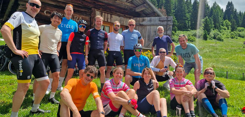
It is 5:00 in the morning when I park my car in front of Pascal's house on August 28. In the coming days, together with Pascal, I will be guiding a number of true adventurers who dared to book the South Tyrol Expedition trip. In four days we will cycle more than 400 kilometers and conquer more than 8,000 meters of altitude. Not nothing! The participants must not only be in top physical condition, they must also be mentally unbreakable!
On the way to Innsbruck, Pascal and I have enough time to go over the entire trip thoroughly. There is a box in the trunk containing the bags for the participants. The bags include the route book. In which it is indicated almost per km where we will cycle. Also a bottle of schnapps. We are going to need each other in the coming days. In an expedition like this you have to work together to ensure that you arrive at your destination every day. There will come a time for everyone to think: “I'm completely done with this, how are we going to solve this.” In those moments we have to be there for each other and we have to motivate each other. Schnapps can help with that.
We are excited
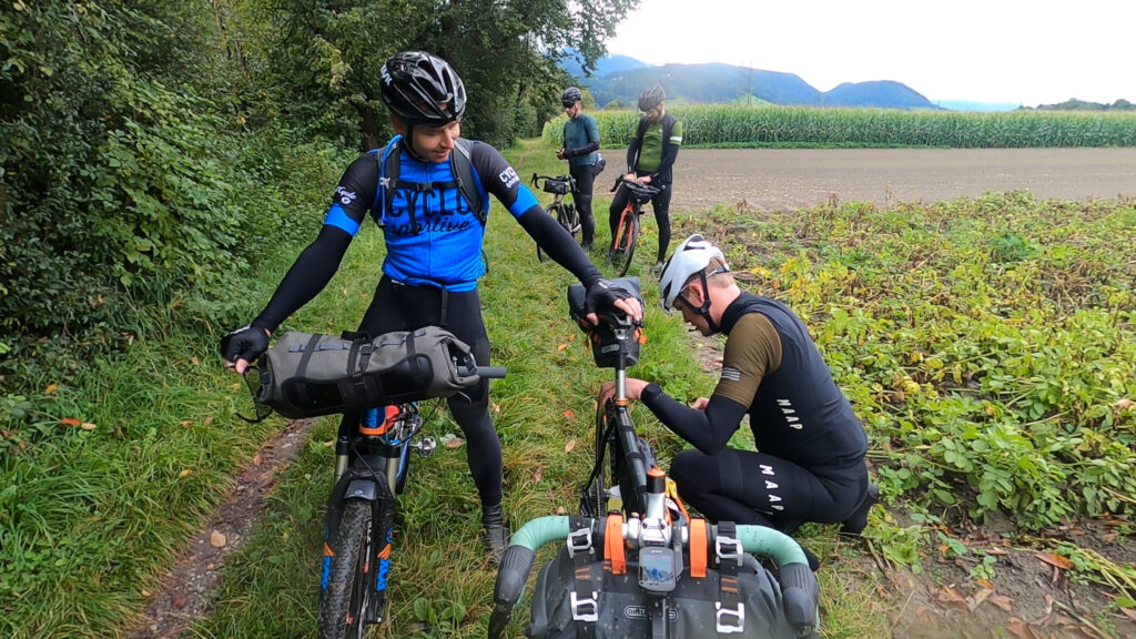
Pascal and I arrive at our hotel in Innsbruck early in the afternoon and wait for the participants. Bob, Rick and Klaas-Jan trickle in late in the afternoon. We can store the bicycles in the hotel meeting room. All setups are reviewed and assessed. “How do you fasten that bag?”, “Oh, that's how it fits you!”, “Nice bike man!”. Everything shows that the men are really looking forward to it, but the tension is also palpable. The excitement of knowing that you are going to do something really cool, but what exactly that will look like is still unclear.
Also for me as an organizer. Last year I already rode a large part of the route. But this year I adjusted part of the route. Even fatter, even more remote and even more rugged terrain. For the unknown parts of the route I took my inspiration from the routes I found on Komoot. The reviews and photos on this platform are a valuable addition for the route builder.

YES! We're going on an adventure!
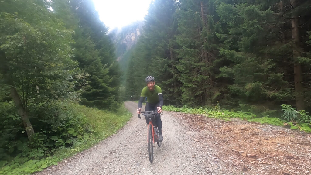
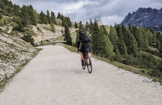
When the alarm clock in our hotel room starts beeping at 7:30, I am standing right next to my bed. YES! We're going on an adventure! A few hours later we cycle out of Innsbruck on our way to the mountains, on our way to the top of the Pfitscherjoch. At least that is the intention. A tram track turns out to be a bigger obstacle than a narrow mountain road with a deep abyss on the right. Behind me I hear a clatter and a few curse words. Bob has gotten his wheel between the tram rails and is lying stretched out on the asphalt. Bike broken, end of exercise it seems. But not at CYCLOsportive. Within an hour we arranged a new bicycle for Bob from a local rental company, Die Boerse. Top! We can move on. After four hours of cycling, the final climb to the top of the Pfitscherjoch looms before us. Until then we cycled through the valley with a gravel strip here and there and we cycled straight through a monastery. Gate open, gate closed, cross the square, gate open, gate closed and through again.
On to the Pfitscherjochhaus
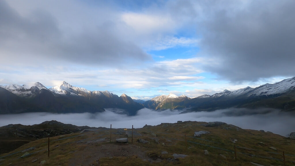
The Pfitscherjoch forms the connection between the Pfitschertal and the Zamser Grund. The pass height forms the border between the Italian province of Bolzano and the Austrian state of Tyrol. What makes this 2,251 meter high mountain so cool is that the top cannot be reached by car from Austria. The long climb to the top begins at Mayrhofen. A year earlier it was brutal weather here. We had serious doubts whether we would reach the Pfitscherjochhaus. Now the weather is a little better, but every now and then there is a splash of rain. We dive into a narrow unpaved path, away from the main road. After a few kilometers the path is blocked by electric fencing and about twenty cows... I see everyone looking at me when they ask who will be the first to push their way through the cows. They are on top of each other. I keep my bicycle between me and the cows. A number of cows do not move an inch. I push them aside with my bicycle. I notice that when I shout 'chop, chop', the cows move out of the way. Apparently I can talk to cows. The cow path is full of shit... When we start cycling again, splashes of shit fly around our ears. Fine!
Four beautiful bends take us to the reservoir
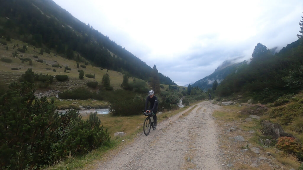
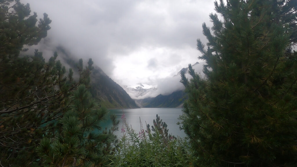
We pass the small village of Ginzling. To avoid a tunnel, we soon turn sharp right onto a dirt road. Here you have to stomp on the pedals to maintain some speed. Everyone is easily carrying 8 kg of luggage. Then climbing on a gravel path a 12% is quite a challenge. We cycle up slowly, panting and puffing. Five kilometers later we reach the asphalt road again. The next obstacle is the Schlegeisspeicher reservoir. Four beautiful hairpin bends take us to the dam. Here is the end exercise for car traffic. The last five kilometers to the top are only accessible on foot or by bicycle.
Two hours for the last 5 km
There is a small shop at the reservoir. We ask the lady behind the counter if she wants to refill our water bottles. No problem. She asks us where the journey is going. When we tell her we are going to the Pfitscherjochhaus, she frowns. The weather is not good, it has become quite cold and she tells us that it is snowing at the top and that she is not sure whether the path to the top is passable... She urges us to be careful. We take her good advice to heart and set off for the last five kilometers. I know what's coming. The last five kilometers will be a test. I tell the others that from now on there will also be some walking to be done. One of the participants asks me how on earth it is possible that it took me more than two hours to cover the last five kilometers last year. “Just wait and see, you'll see,” is my only answer.
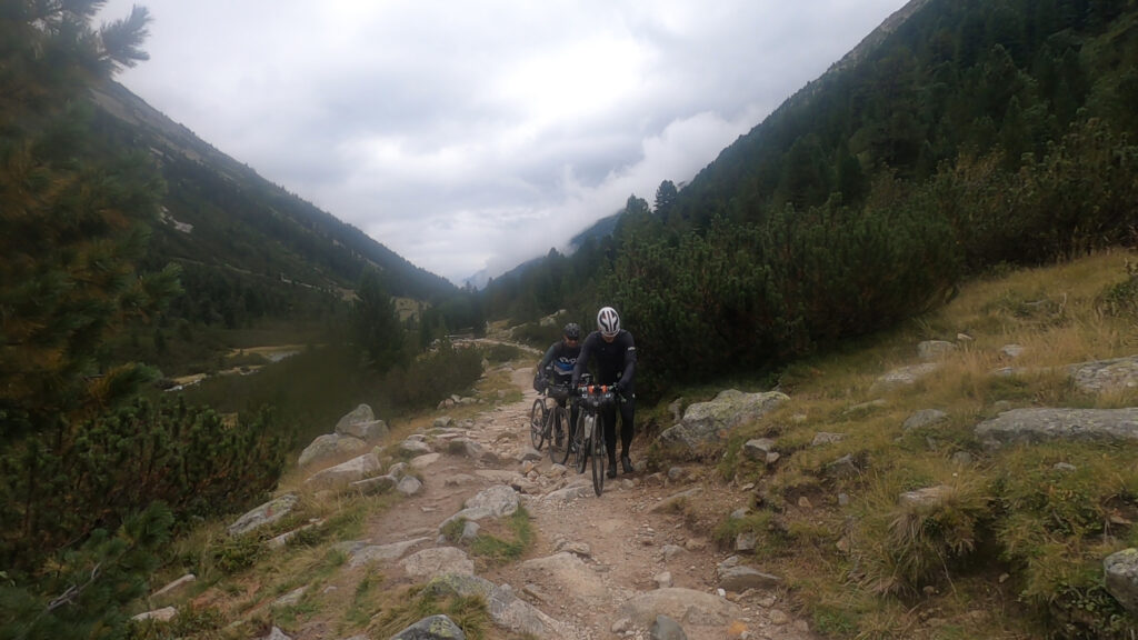
We are in the middle of no-where
We start our way up along the narrow river with the Zamserbach. The friendly gravel path quickly turns into a difficult and narrow path with large boulders and boulders. We regularly have to get off our bikes and go for a walk. When we get on again, we are back next to the bike after less than 100 meters. Here we walk between mighty high peaks on a narrow path towards the Italian border. Walking normally wouldn't be a big problem. But walking in cycling shoes is. Even if they are mountain bike shoes. With SPD-SL pedals it would have been completely impossible. Walking is not very difficult for me, but Klaas-Jan clearly has more difficulty. His new shoes with stiff carbon soles are having a hard time. And just like the weather around us, Klaas-Jan's face is like thunder. I stay near him, but don't get too close. Klaas-Jan doesn't appreciate my bad jokes right now. We continue and the terrain becomes rougher and rougher. We clamber over boulders with all our gear, drag our bikes up steep stairs and pass mountain streams on narrow planks. We are in the middle of no where!
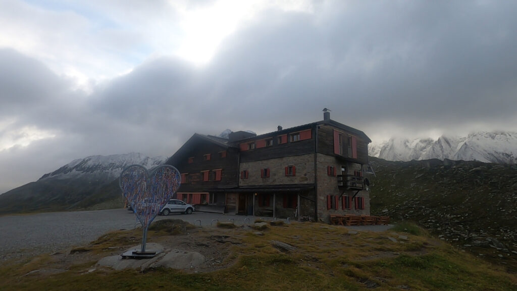
We made it!
With one kilometer to go, we see the Pfitscherjochhaus in the distance. One more steep climb over a road full of loose stones and then we can have some pasta and a well-deserved beer. A year earlier, this last kilometer was tough, but easy to cycle. Nature does what it wants with the roads here high in the mountains. Parts of the road have been washed away. It's a struggle. Fortunately, the lady from the shop at the reservoir is wrong. There is no snow. And although we still have to walk in the last kilometer, we know that we will reach the finish. A large white sign welcomes us to South Tyrol. Another maximum 100 steep meters to the Pfitscherjochhaus. We made it!
Would you like to experience this adventure with us? We'll go again next year!