Dolomites expedition: one big adventure!
Cycling on gravel roads and bikepacking is becoming increasingly popular. Events are springing up like mushrooms. In 2020, CYCLOsportive organized Expedition Dolomites for the first time. At the end of August it was already the third edition of this great adventure through Austria and Italy. One big adventure!
Text and image: Gerrit Vermeulen
With 120 km and 2,700 hm's, stage 3 is a real Queen's stage
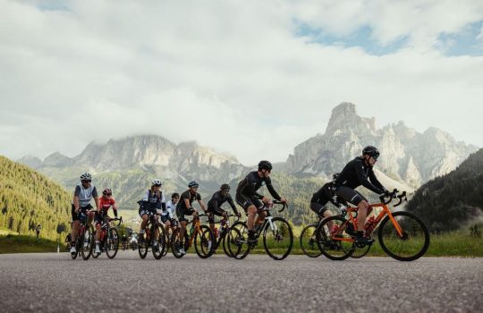
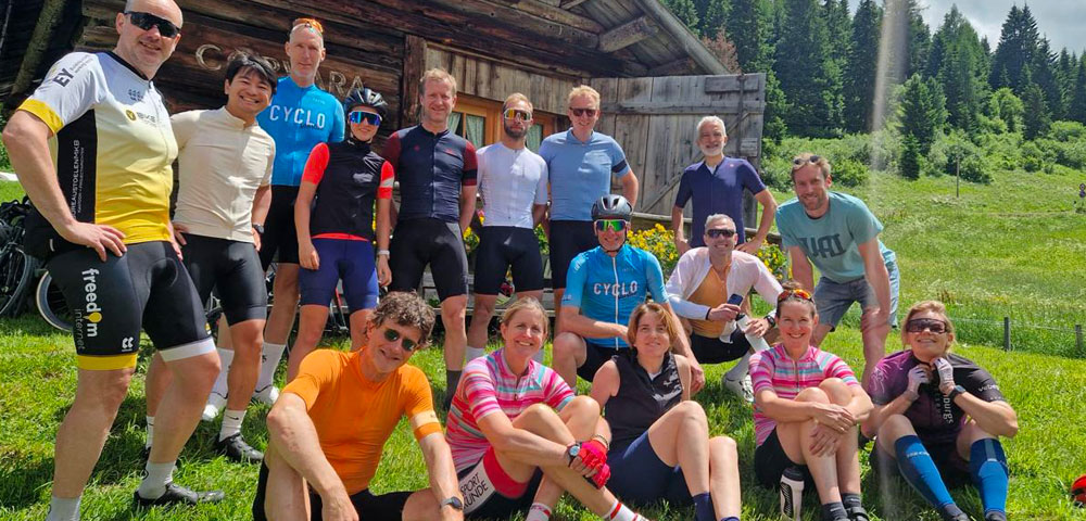
For the third time, the Dolomites Expedition was on the program from August 27 to September 1. Four days of cycling through the wild nature of Tyrol and South Tyrol. A bit Spartan, but also with a bit of luxury. In our opinion, a nice combination. While the Dolomites Expedition started in Innsbruck the previous two years, this year the start was in Tulfes. A small, typical Tyrolean village a stone's throw from the big city. In four days, the participants will cover more than 400 km and almost 10,000 meters of altitude!
It's a race, but not a race
In contrast to the previous editions, a competition element has been added in the third edition. Participants set out solo, had to pass a number of checkpoints and could earn points towards the rankings along the way. A ranking with a wink. The Dolomites Expedition is not about cycling from A to B as quickly as possible. Camaraderie, perseverance and mental toughness may be weighed more heavily than the fastest time.
Stage 1: Tulfes-Pfitscherjochhaus | 101km | 2,400 hms
It is raining when we open the shutters of Gasthof Neuwirt in Tulfes. For the third year in a row, the first day of the Dolomites Expedition is a rainy day. Is it that time of year? When the participants are packed and standing in front of the hotel at 8.30 am, it starts to rain. The tops of the mountains are shrouded in mist. Today adventurers have a choice of two routes. A shorter, but arduous route of 84 km with 3,500 hm's or a longer route of 101 km with 2,400 hm's. The tour guide determines that the weather is too uncertain to take two unpaved mountain passes and all participants cycle the long route. Safety above all. Through the valley we go towards Mayrhofen. Along the way we take a few short climbs and some gravel paths. The challenge of stage 1 is in the last 15 km. From Mayrhofen it goes gradually uphill. Fortunately we are spared the rain. From Mayrhofen it's every man for himself. Climbing is best done at your own pace.
Pfitscherjochhaus
After Ginzling we turn sharp right onto a grave road just before the toll tunnel. It's quite a climb to get around the tunnel! But it is a beautiful climb. Once back on the asphalt, 5 hairpin bends separate the fallen group from the last part of the route. After the Schleggeispeicher reservoir, things will be tough for the participants! The road is more of a walking path than a path suitable for cyclists. Some parts require walking. It doesn't bother any participant. The surroundings are beautiful! The last km is tough and rough. When we pass the Welcome to South Tyrol sign just below the summit, we know we are almost there: the Pfitscherjochhaus. Just before the top we see the banners CYCLOsportive Supervisor Rutger Jan is waiting for the participants one by one. It's five degrees at the top. But the adventurers love to let the warm blanket wrap themselves around them. The schnapps provided is also more than welcome!
Stage 2: Pfitscherjoch-Dürrensteinhütte | 129km | 2,100 hms
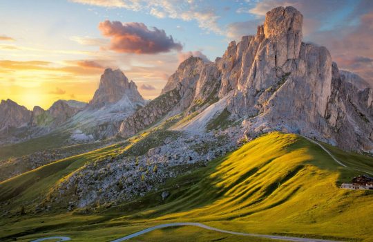
Waking up on the Pfitscherjoch at an altitude of 2,276 meters is an experience. At this height the view is phenomenal. There is one mountain hut and otherwise only the rugged nature of South Tyrol. When the clouds have cleared a bit, we look far below us towards the Puster Valley. Today the participants cycled more downhill than climbing. Nevertheless, more than 2,000 meters of elevation are still gained. Leader in the rankings Douwe has been fooled by pursuer Guy from the start. A number of participants race in the Puster Valley. When we decide to have lunch in Bruneck, Daan (number 3 in the rankings) decides to continue cycling. No problem. Dolomites Expedition is a self-supported event, where everyone has to make their own decisions. Douwe is not feeling well. He restlessly 'enjoys' his pizza, disappointed that Daan has driven on. We won't see Daan again. He covers the last part of the route solo.
Prato Piazza
The climb to the finish is a tough one! Although it is more downhill than uphill in stage 2, after 114 km, 15 km of climbing still hurts. These are not the nicest gradients either. Five kilometers before the end, the participants are even faced with a 1.5 km section in which they have to climb a 15%! Once again, all that hard work is paying off. After the steepest part at Prato Piazza, the road turns into a gravel road to the Dürrensteinhütte. The Dürrensteinhütte is the beautiful final station of stage 2. More touristy than the Pfitscherjoch, it must be said, but the view here is once again phenomenal. From a distance we see Rutger Jan standing there. The CYCLOsportive banners flutter in the wind. No more clouds in South Tyrol. No cold temperatures. After stamping the Expedition Dolomites passport, the participants can enjoy a drink and each other's stories in the sun.
Stage 3: Dürrensteinhütte-Fortezza | 120km | 2,700 hms
The third stage is truly the Queen's stage with a choice of three tough routes. Most participants start with a beautiful gravel descent, and then head over the old railway line (now a gravel road) to Fanes Sennes Nature Park. Today the group is mainly dependent on itself. The terrain is so demanding that the group falls apart from the first kilometer. The climb to Rifugio Ra Stua is killer. The participants crawl up here painfully slowly. The climb of only 4 km does not fall below the 10% gradient. We see more 15% on our cycle computers than we would like. After Ra Stua we can take it easy for a while. It is a harbinger of a lot of misery.
Rifugio Pederu
After cycling for a few kilometers on a beautiful gravel road in beautiful nature, the road suddenly goes uphill. Cycling becomes impossible at a certain point. All participants must get off their bikes. Is hike-a-bike part of bikepacking? We think so. Looking around you you feel the power of nature. We have nothing to say here. We also continue to enjoy the surroundings while walking! When you think you have had it all and you can get back on your bike, the descent to Pederü follows... Not normally steep. There are participants who are able to complete this part of the route by bicycle. I walk the steepest parts myself. My bike wants to move faster than my legs can handle. Fortunately, everyone makes it down unscathed.
Passo delle Erbe
We called day three THE Queen's stage. Pederü would be a beautiful finishing point for day three, but the participants can only relax here for a while. The end point is not Pederü, but Fortezza. Before the participants arrive there, a few mountain passes still have to be conquered, including the Passo delle Erbe, ± 25 km of climbing with an average of 8%. It is warm in the valley and when the participants start the long climb around noon it is over 20 degrees. Add to that what the participants have already accomplished and you know that this is a tough climb. The battle for the day's profit is again between Guy and Douwe. Clearly the two strongest cyclists. But everyone encounters themselves today. Together with Pascal we decide to have an extensive lunch at the top of the Passo delle Erbe. No punishment at Utia Börz! Then it is down to Brixen and via a sloping road towards Fortezza to be welcomed by Rutger Jan with a delicious BBQ.
Stage 4: Fortezza-Tulfes | 97km | 2,100 hms
The participants are tired, logically. But after a good breakfast at Hotel Sachsenklemme, they really have to give it a go. One more day of enjoyment/suffering during the Dolomites Expedition. A crash (on day 3) with a motorcyclist in which tour guide Gerrit from CYCLOsportive breaks his arm instantly makes the rankings a lot less important. An accident can happen anywhere... The group has a choice of two routes on the last day. A route with and a route without the Brenner Grenzkamm.
Brenner Grenzkamm
The Brenner Grenzkamm is an old military road high above the Brenner Pass. From Vipiteno the toughest participants start the challenging climb to the Brenner Grenzkamm. A dirt road full of hairpin bends leads the men to a hopefully beautiful view of the Brenner. Douwe climbs the best and emerges into a spooky landscape. It is completely sealed and the mist fragments give the Brenner Grenzkamm something mysterious. A year earlier, the view of the surrounding mountain peaks was phenomenal. Now there is nothing more to see than a narrow unpaved mountain road and a dozen goats blocking the road. There's something to it too. After the descent, the participants still have to climb a few kilometers towards the finish in Tulfes. The medal with the text 'You are tough enough' is more than deserved! Who was the winner? Douwe (van Douwe does things) has rightly been declared the winner.
The Dolomites Expedition is on the program again next year. We have managed to make the route even more beautiful. Discovered a number of beautiful gravel roads again. We have redesigned parts of the route. It certainly won't be boring again. Are you tough enough? Are you coming?


